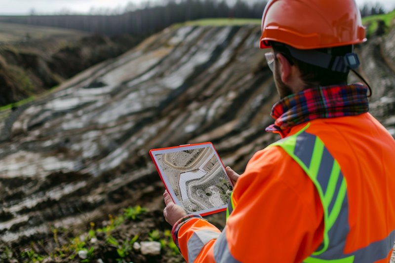
Geophysical Surveys
The Earth's crust is not just comprised of the mountains, plains, and valleys we see on the surface. The truly important aspect lies in the properties of the layers beneath the surface. Every engineering structure—be it a residence, a bridge, or a dam—rests on these subsurface layers. Geophysical surveys are one of the most effective methods for understanding the depths of the earth's surface. Rhino Engineering utilizes modern geophysical methods to reveal subsurface structures scientifically, reliably, and quickly, illuminating engineering projects.
What are geophysical surveys?
Geophysics is the branch of science that examines the properties of underground structures and layers using physical principles. Geophysical surveys allow us to obtain detailed information about the structure of underground layers without drilling, that is, without direct excavation or drilling. These methods are indispensable for obtaining information quickly and economically, especially over large areas.
Geophysical surveys performed by Rhino Engineering include:
Determining subsurface layer boundaries,
Determining soil and rock properties,
Measuring groundwater levels,
Detecting voids, cracks, buried structures, or weak zones,
Collecting seismic data for earthquake risk analyses.
The Importance of Geophysical Surveys
Geophysical surveys are a preventative measure in engineering projects because they reveal the risks inherent in the ground before a structure is constructed.
For example:
The presence of buried karst cavities along a road route can be determined using geophysical methods.
The presence of impermeable layers during dam construction can be determined using seismic methods.
The groundwater level can be determined using electrical resistivity measurements.
This information allows necessary precautions to be taken before the project begins, reducing costs and increasing safety.
Rhino Engineering's Geophysical Survey Methods
1. Seismic Methods
Used to examine the elastic properties of subsurface layers. Rhino Engineering utilizes the following methods:
Seismic refraction: Determines layer boundaries and wave speeds.
Seismic reflection: Provides detailed imaging of deeper structures.
Microtremor and MASW studies: Determines ground dominant periods and Vs30 values (used in earthquake regulations).
2. Electrical methods
Based on the electrical resistivity properties of subsurface layers.
Electrical resistivity: Detects groundwater, voids, and different lithologies.
IP (Induced Polarization): Used in mineral exploration and water saturation determination.
3. Magnetic methods
Buried structures and fault zones are identified through magnetic anomalies in the subsurface.
4. Gravity methods
Detects underground voids or different rocks by measuring density differences.
5. Georadar (GPR)
Imaging buried structures by sending electromagnetic waves to the ground surface. It is particularly effective in:
Historical artifact surveys,
Detection of underground installations,
Mapping of soil layers.
Application Areas of Geophysical Surveys
Rhino Engineering applies geophysical surveys in a wide range of applications:
Civil engineering projects: For soil classification, liquefaction analysis, and foundation design.
Dams and reservoirs: Detection of water leakage routes.
Highway and railway projects: Detection of voids and fault lines along routes.
Mineral exploration: Detection of mineralization zones.
Groundwater surveys: Optimization of drilling points.
Archaeology and cultural heritage: Detection of historical structures.
Earthquake surveys: Determination of ground dominant periods and acceleration values.
Importance of Geophysical Surveys for Turkey
Geophysical surveys are of great importance because Türkiye is located in an earthquake zone. In particular, soil classification (such as ZC, ZD, ZE) and Vs30 measurements are essential for designing structures in compliance with earthquake regulations. Furthermore, problems such as landslides in the Black Sea, settlement in Central Anatolia, and liquefaction in the Aegean and Marmara regions can only be predicted through geophysical studies.
Rhino Engineering develops customized solutions suitable for Turkey's diverse geographical and geological conditions.
Rhino Engineering's Geophysical Reports
The reports prepared by the company include the following information:
Soil layer thickness,
Seismic velocities (Vp, Vs),
Groundwater level,
Location of fault lines,
Liquefaction potential,
Earthquake parameters,
Recommendations for foundation design.
These reports provide a scientific and official basis for engineering projects.
Rhino Engineering's Difference
Rhino Engineering offers the following in geophysical surveys:
State-of-the-art equipment (seismographs, GPR systems, electrical resistivity meters),
Experienced expert staff,
Reporting in accordance with national and international standards,
Multidisciplinary approach (integration of geology, geotechnics, and geophysics),
Fast, economical, and reliable solutions.
Conclusion
Geophysical surveys contribute to the eco-friendly design of engineering projects.