Geological Surveys
The Earth's crust is a dynamic structure, constantly in motion and shaped by various geological processes over millions of years. Buildings, dams, roads, bridges, and all other engineering structures built on it rest on this foundation. Therefore, detailed investigation of the ground and environmental conditions is crucial in any engineering project. Geological surveys are one of the most critical stages in terms of both safety and sustainability. With its expert staff and state-of-the-art equipment, Rhino Engineering offers scientific, technical, and innovative solutions in geological surveys.
The Importance of Geological Surveys
Before a structure is constructed, detailed information about the ground on which it will stand is essential. Inaccurate or incomplete geological surveys can lead to post-construction collapses, settlements, landslides, floods, and even loss of life. Especially in countries located in earthquake zones like Turkey, geological surveys are not only essential for engineering purposes but also a vital necessity.
Rhino Engineering conducts its research:
Determines soil structure, rock properties, and subsurface layers.
Analyzes earthquake risk and fault line proximity.
Identifies risks such as landslides, liquefaction, and collapse.
Examines groundwater levels and hydrogeological conditions.
Prepares land use suitability reports.
This makes projects safer, more durable, and more durable.
Rhino Engineering's Geological Exploration Processes
Geological exploration is a comprehensive process consisting of many stages. Rhino Engineering meticulously conducts these processes:
1. Preliminary surveys
First, general information about the site is collected. Satellite images, topographic maps, past research, and geological maps of the region are examined. This preliminary preparation informs the work to be carried out in the field.
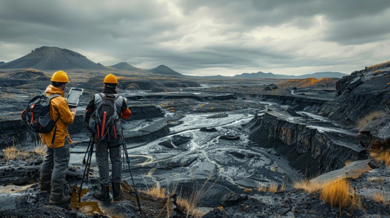
2. Field observations
Geologists go into the field and examine the rocks, soil structure, fault lines, cracks, and other geological features visible on the surface. Landslide-prone areas, slope differences, and signs of erosion are recorded.
3. Drilling and sampling
Drilling operations are conducted to examine the layers deep within the ground. Samples from these drillings are sent to the laboratory for detailed analysis.
4. Laboratory analyses
Mineralogical, petrographic, chemical, and mechanical tests are performed on the collected samples. This determines the durability, bearing capacity, and water permeability of the soil and rocks.
5. Geological mapping
All the obtained data is compiled to prepare geological maps. These maps show the geological structure of the land in detail.
6. Reporting
Finally, all findings are presented in a report that complies with national and international standards. This report guides the investor, engineer, or public institution that will undertake the project.
Uses of geological surveys
Geological surveys are necessary not only for construction projects but also for many other areas. Rhino Engineering offers this service in the following areas:
Residential and business center projects: Soil properties are determined to ensure the safety of structures.
Dam and reservoir construction: Soil impermeability is tested in water retention structures.
Highway and railway projects: The soil and rock structure along the route is analyzed.
Mining projects: The geological structure of reserve areas is examined.
Industrial facilities: Soil strength is determined for large structures such as factories and power plants.
Urban planning: Land use suitability is investigated in urbanization projects.
Methods Used by Rhino Engineering
The company applies the most up-to-date methods in geological surveys:
Geological mapping techniques,
Drilling methods (rotary, core, and percussion drilling),
Microzonation studies,
Geotechnical testing,
Laboratory experiments,
Groundwater measurements,
Integration with Geographic Information Systems (GIS).
Thanks to these methods, surveys provide detailed information not only on the surface but also underground.
The Importance of Geological Surveys in Turkey
Turkey is located in one of the world's most active earthquake zones. The North Anatolian Fault Line, the East Anatolian Fault Line, and the West Anatolian Graben System pose serious risks in various regions of the country. Furthermore, landslide risks are high along the Black Sea and Mediterranean coasts, and subsidence and collapse risks are high in Central Anatolia. Therefore, geological surveys are not only a technical necessity but also a necessity for the safety of life and property.
Through their geological surveys, Rhino Engineering:
Ensures the development of projects compliant with earthquake regulations,
Provides solutions in landslide-prone areas,
Helps identify areas unsuitable for settlement,
Supports land-use decisions for agricultural, industrial, and energy projects.
Rhino Engineering's Difference in Geological Surveys
What distinguishes Rhino Engineering from other companies are:
Experienced expert staff